Tamtamdomani, Libro Aperto, CC BY-SA 3.0
Abetone is definitely known for its ski areas and the slopes that are filled with people in winter. The snow-capped mountains and the huts make this place very popular but also during the summer it deserves to be visited.
In fact, these areas are rich in paths for short or long walks that lead you to discover breathtaking views; trekking routes from the easiest ones to be addressed also with children, to the most demanding ones.
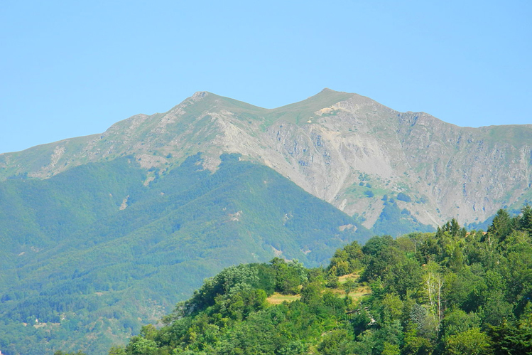
One of the most beautiful is that which leads to the Libro Aperto; a mountain group formed by two peaks that resemble a large open book from a distance.
The ring route starts from the Abetone pyramids, built to mark the border between Tuscany and Emilia during the Grand Duchy; here there is the tourist office that provides the map of the paths free of charge.
It starts, then, with the actual walk along the path CAI 00 that leads into the forest of firs called Boscolungo, an enchanted place.
The route here is not demanding and after about an hour you reach the “Foce delle Verginette”; here the forest ends and we find ourselves surrounded by meadows and mountains. Here is the Rifugio Casetta di Lapo which offers typical mountain dishes, such as polenta with mushrooms and soups, to be enjoyed before leaving for the final destination.
Now it is possible to continue on path 00 that leads directly to the Open Book, or follow path 495, a little longer but less demanding than the other; choosing this path will also meet the Lago della Risaia.
The paths are all well marked and clean, the only difficulty will be given by the climb. Climbing, the surrounding peaks and green meadows will be more and more visible and the expanses of blueberries will be more and more present.
Once you reach the top of Monte Rotondo, the view will be unique; looking around you will be able to see the peaks of the Appenino Tosco Emiliano and the neighboring provinces.
After filling your eyes with this show, having a picnic (respecting nature) and a few photos, to go back to the starting point, just take the CAI path 00.